Relief Line Toronto
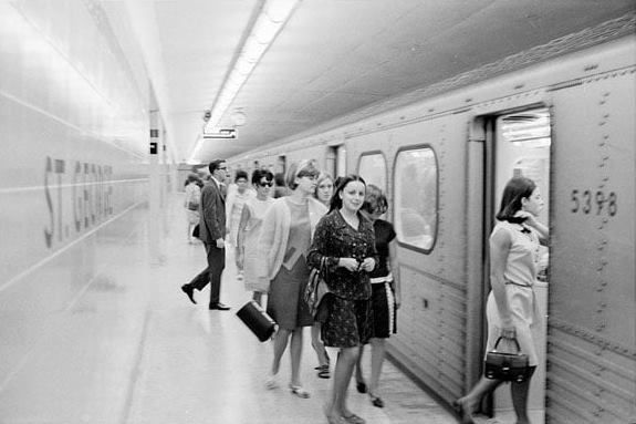
In the mid 1950s, Toronto became the latest city to develop an underground system to make it easier for its residents to get around the city with the minimum of fuss.
It was an idea that took three and a half decades to evolve from the moment it was proposed in 1910 to provide a route around the city from Broadview Station to West Toronto Diamond via Spadina Avenue, Dovercourt Road, Bloor Street and Dundas Street.
But over time, the city’s population grew which led to an increase in the use of the underground streetcar.
A revamp would cause major disruption to the infrastructure, but the short term pain would lead to a long term gain.


Many thanks for supporting the project to: Toronto Zoo, Royal Bank of Canada, CTV, Government of Ontario, Attractions Ontario.
What is the Relief Line?
The Relief Line is exactly what the name suggests.
The Downtown Relief Line (DRL Toronto) is an underground railway network designed to provide a downtown relief line to the city in terms of transporting commuters around the city.
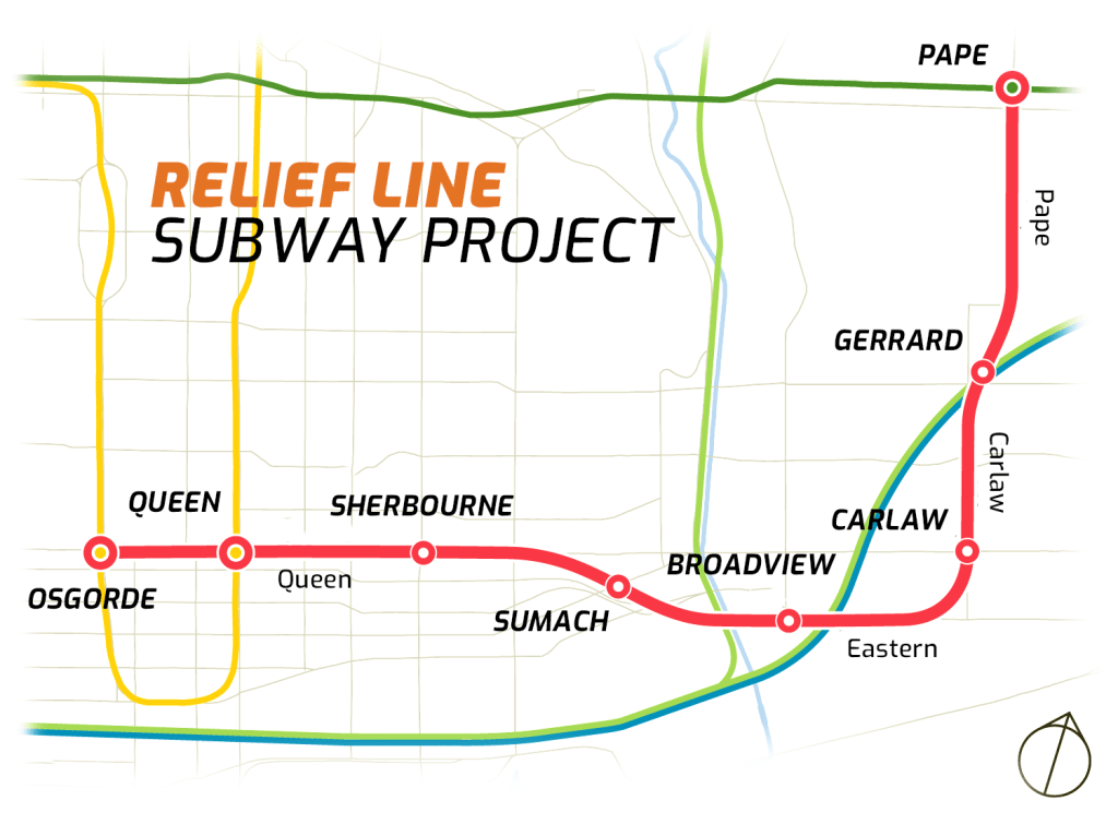
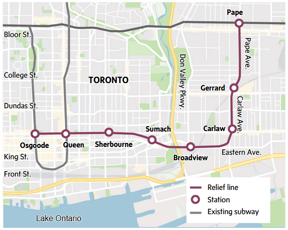
The additional line would operate from Pape Station and over the course of the project which would last 25 years would lead to Union Station.
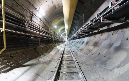
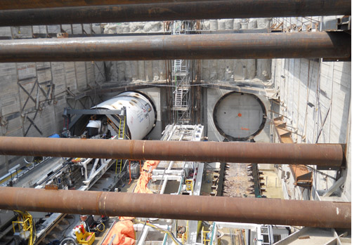
Relief Line Subway Project
Adjustments were made to the initial project and $150m worth of funding was allocated to the scheme that was scheduled to open in 2029.
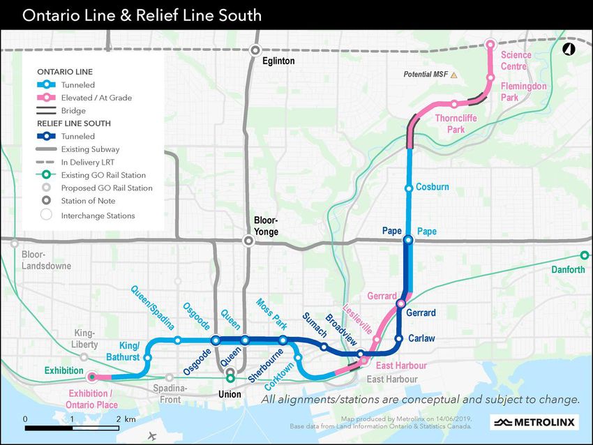
However, the Relief Line project was consigned to history in April 2019 when a new Ontario Line would be constructed instead to operate from Science Centre Station to Exhibition Place.
For the best part of last decade, the rush hour trains have operated over capacity and the new route would allow commuters to avoid those busy stations as they head towards the city center.
Terms of Reference
The Relief Line was designed to provide capacity relief to the Yonge Segment and Bloor-Yonge stations.
It would connect the east side of the city to the west.
It was aimed to reduce transfers at Bloor-Yonge station and Line 1 (Yonge) riders by 30 per cent and 12 per cent respectively.
The proposal was to redirect up to 35 per cent of commuters heading into downtown from the east on the King or Queen routes to the Relief Line.
Challenges
One of the main challenges faced by the Relief Line plans was congestion.
The Toronto transit plan would increase capacity by up to 35 per cent by introducing new ‘rocket’ subway trains and automatic train control.
A study highlighted that passengers per hour in peak direction would increase by 46.2 per cent from 26,000 to around 38,000.
Transit Technology
A feasibility study into multiple transit technologies found that the subway was recommended because it provides sufficient capacity for long-term commuter needs and offers a high speed and frequent service to attract passengers away from the Bloor/Danforth subway.
The subway also supports city-building aims and minimises disruption to existing neighborhoods and it can maximise existing facilities for maintenance purposes and for storing vehicles.
Routes and Stations
When the four lines opened, the Toronto subway lines were named after the geographical locations they served.
But in 2014, the decision was made to also give each line a number to identify it more easily.
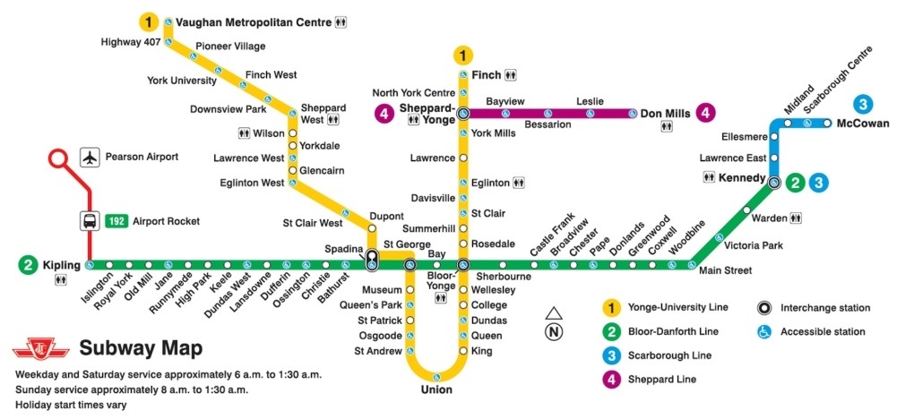
The Yonge-University line was called Line 1 while the Bloor-Danforth line was named Line 2.
The Scarborough RT was to be known as Line 3 and the Sheppard route became Line 4.
The overground stations on the Relief Line include Science Centre, Flemingdon Park.
The stations on the Relief Line include Station Centre, Flemingdon Park, Thorncliffe Park, Cosburn, Pape, Gerrard, Carlaw, Broadview, Sumach, Sherbourne/Queen, Queen, Osgoode, Spadina/Queen.
Why the Ontario Line instead of the Relief Line?
After the Relief Line fell down the pecking order of transit plans because of construction costs, another plan was needed to alleviate the congestion issues.
The Ontario Line was born which would link the city from north to south taking in some of the Relief Line locations some of which were partially built.
The new proposal is 15.5km long compared to the Relief Line which was designed to be 7.4km long.
Perhaps more importantly, the number of stations on the Ontario Line Line would almost double from eight on the Relief Line to 15.
While it might cost more, the significance benefits are clear for all to see not just for the present but the future as well with more and more commuters using the line after Covid-19.
Ontario Line/Relief Line comparison:
Length: 15.5km – 7.4km
Number of stations: 15 – 8
Estimated cost: $10.4b to $12b – $8b to $9.2b
Expected completion: 2027 – 2029
Train type: Light metro – Heavy train
Passenger capacity per train: 850 – 1,100
Train frequency: 90 seconds – 140 seconds
Daily boardings: 389,000 – 206,000
TOP facts about the Toronto Metro:
- The Toronto subway opened in 1954 making it Canada’s first ever subway.
- It currently has 75 stations along the four lines of the 76.5km infrastructure.
- Over 210 million commuters use the metro every year.
- Constructing the initial metro required 1.4m bags of cement.
- The final cost of the constructing the metro was $67m.
- The original trains used were still in operation until 1990.
As Toronto continues to grow in population, so too does the transport system designed to help them navigate the city easily and cheaply.
The subway offers the perfect solution to this.
Subway Map of Toronto
However, work to improve the infrastructure will cause disruption during construction which is why the project has to be thought out thoroughly so that the next revamp is not required for another decade or two.